The South African Weather Service has issued severe weather warnings for large parts of the country as an intense cut-off low moves across South Africa from Tuesday, bringing flooding, heavy snowfall on high ground, gale-force winds and wave heights of up to 7 metres along southern and eastern coastlines.
The system is expected to track eastward between 5 and 7 May, with the worst conditions affecting the Western Cape, Eastern Cape and parts of KwaZulu-Natal.
A cut-off low is a slow-moving low-pressure system that separates from the main westerly wind stream and can produce prolonged, intense rainfall over a fixed area for several days.
SAWS has classified this event as among the more significant autumn weather systems of the year, issuing orange Level 6 warnings across multiple provinces for conditions expected to intensify through Tuesday afternoon.
What the SAWS warnings cover
Orange Level 6 warnings are in effect along the Eastern Cape coast between Tsitsikamma and Kei Mouth, where disruptive rain is expected to cause flooding of settlements, roads and low-lying areas, with some communities at risk of being temporarily cut off. The warning period extends into Thursday, 7 May.
KwaZulu-Natal faces a separate Level 6 warning for severe thunderstorms across its north-eastern and south-eastern regions, with strong damaging winds, hail and heavy downpours forecast to cause road flooding and infrastructure damage.
Disaster management teams in the province have been placed on high alert.
Wave heights along exposed coastal stretches are expected to reach between 5 and 7 metres, creating dangerous conditions for marine navigation and posing a risk to coastal infrastructure.
Storm surges are also possible along affected sections of coastline.
Which areas face the greatest risk and where snowfall is expected
The Western Cape faces disruptive winds and heavy rain, with gale-force conditions expected on exposed mountain passes and along the Garden Route. R
SAWS confirmed that the system is bringing flooding and strong winds directly to the Cape, with conditions building through Tuesday afternoon.
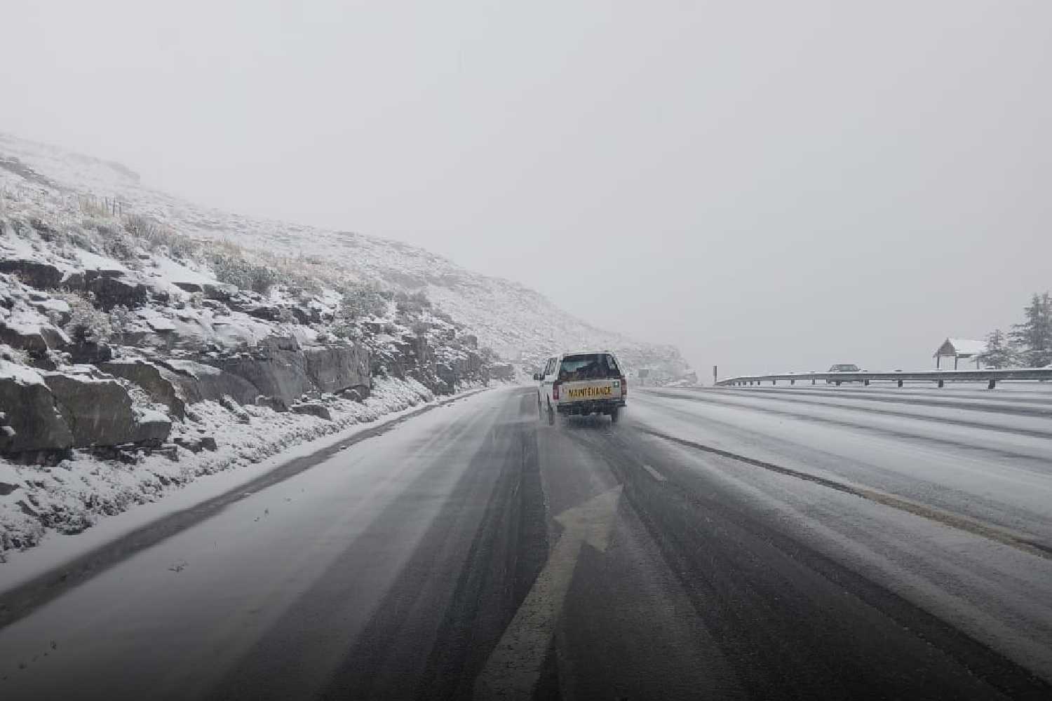
Snowfall is expected over the north-eastern high ground of the Western Cape, particularly in the Central Karoo, where overnight temperatures are forecast to drop sharply.
Mountain passes in the region may become icy from early Wednesday, and travellers on routes including Huguenot Tunnel, Bain’s Kloof and Swartberg Pass should anticipate hazardous conditions.
Residents in affected areas are advised to avoid unnecessary travel over mountain passes and coastal roads during the peak of the system. Emergency services across the Western Cape, Eastern Cape and KwaZulu-Natal have been notified and are monitoring conditions.
The cut-off low is expected to weaken and move off the east coast by 8 May. SAWS has indicated it will issue updated warnings as the system develops, with the Friday forecast expected to confirm whether residual moisture will affect the South African interior heading into the weekend.